
While surface surveyors contend with weather, vegetation, and satellite geometry, underground and mining surveyors operate in one of the most hostile, hazardous, and technically demanding environments in the geospatial profession. Deep beneath the Earth’s surface or inside cramped subterranean tunnels, Global Navigation Satellite Systems (GNSS) are completely unavailable because satellite signals cannot penetrate rock, soil, or massive concrete structures. Mining and tunneling surveying—often called underground surveying—is the highly specialized discipline responsible for establishing spatial control, guiding giant tunnel boring machines (TBMs) to exact sub-surface breakthrough points, mapping complex ore bodies, and calculating extraction volumes to ensure structural safety and economic viability.
The Ultimate Challenge: Transferring Surface Control Underground
The most critical operation in any tunneling or deep mining project is transferring the surface coordinate system and orientation underground. When constructing a major transport tunnel or water conveyance conduit, excavation frequently begins simultaneously from opposite portals (such as opposite sides of a mountain range or across a body of water) or down vertical shafts. If the surface control network fails to transfer accurately underground, two opposing tunnels will miss each other when they meet in the middle—a catastrophic engineering failure resulting in massive financial losses and schedule delays.
Surveyors transfer control through two primary mechanisms:
- Vertical Shaft Transfer (Plumbing): When dropping control down a deep vertical mine shaft, traditional optical plummet instruments or high-strength steel piano wires weighted with heavy plumb bobs immersed in damping oil are lowered down the shaft. Because air currents and swinging drafts can deflect physical wires, modern surveyors use high-precision optical plummets, laser alignment systems, and multi-station resection to project surface coordinates down hundreds of meters with millimeter precision.
- Gyro-Theodolites (Meridian Finding): In long horizontal adits or tunnels where intervisibility with the surface is lost, surveyors cannot rely on magnetic compasses due to local magnetic interference from iron ore bodies, electrical cables, and heavy mining machinery. Instead, they use a gyro-theodolite—a specialized instrument containing a motorized gyroscope that senses the rotation of the Earth to find true astronomic north independently of external reference points, establishing precise azimuth control underground.
Specialized Instrumentation and Surveying Techniques Underground
Working underground requires ruggedized instruments designed to withstand extreme humidity, dust, corrosive moisture, dripping water, and vibration:
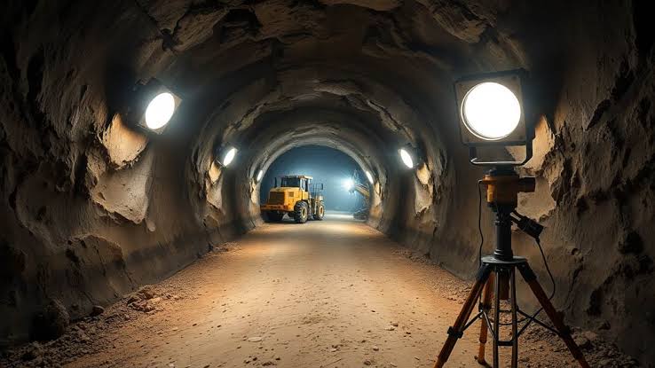
- Underground Traversing: Because underground lines of sight are short and confined by tunnel walls, traverses must consist of numerous short legs. To prevent angular errors from compounding rapidly over long distances, surveyors use high-precision robotic total stations mounted on heavy, stable tripods or pinned to permanent roof and floor bolts (known as spad plugs). Every station must be measured with rigorous forward and reverse rounds, and trigonometric leveling must be executed with extreme care.
- Laser Scanning in Subterranean Spaces: Terrestrial Laser Scanners (TLS) and mobile mapping backpack units have transformed underground safety and documentation. In active mines and active tunnels, scanners capture complete 3D point clouds of stopes, tunnels, and structural supports in minutes. These scans reveal overbreak (areas where too much rock was blasted, weakening the structure) and underbreak (areas where rock remains, blocking clearance limits) instantly.
- Tunnel Boring Machine (TBM) Guidance Systems: Modern TBMs—massive mechanical excavators costing tens of millions of dollars—rely on continuous laser guidance systems. A robotic total station mounted behind the cutter head continuously tracks targets affixed to the rear of the TBM, feeding real-time roll, pitch, heading, and chainage data to the operator’s console. This ensures the multi-million-dollar machine stays strictly within millimeter tolerances of the engineered vertical and horizontal alignment profile.
Mining Operations, Volumetric Tracking, and Ore Control
In hard-rock and coal mining operations, the surveyor’s role is inextricably tied to production efficiency and resource management:
- Stope and Ore Body Mapping: Underground metal mines extract ore from underground chambers called stopes. Surveyors map these irregular voids after blasting using laser scanners or cavity monitoring systems (CMS) deployed on extendable booms. Comparing pre-blast and post-blast scans calculates precise extraction volumes and dilution rates.
- Open-Pit Mine Surveying: Surface mining operations combine GNSS machine guidance, drone photogrammetry, and robotic total stations to monitor bench heights, haul road gradients, highwall stability, and monthly volumetric stockpiles of extracted ore and waste overburden.
- Mine Safety and Statutory Compliance: Mining laws require accurate, up-to-date mine plans (mine maps) to be filed regularly with government regulatory bodies. These plans document active workings, escape routes, ventilation networks, old abandoned workings filled with water or toxic gases, and property boundary limits to prevent underground miners from accidentally mining into adjacent properties.
Managing Subsidence and Subterranean Hazards
Subsurface excavation inevitably alters the surrounding rock stress equilibrium, causing surface land subsidence or structural shifting above the mine. Mining surveyors establish extensive surface and subsurface monitoring arrays—utilizing precise leveling loops, tiltmeters, and satellite InSAR—to track ground settlement profiles around active longwall coal mines or urban subway tunnels. By identifying early indicators of rock shear or surface cracking, they protect surface infrastructure, highways, and residential communities from unexpected subsidence damage.